
Archive For The “Maps” Category

The U.S. power grid is divided into three parts: 1) Most of Texas, 2) Eastern Interconnect which is everything east, and including, Kansas, Nebraska, Oklahoma, the Dakotas and northern Texas; 3) West Interconnect which is everything west of, and including, New Mexico, Colorado, Wyoming, and Montana. Power is transferred from low demand regions to…
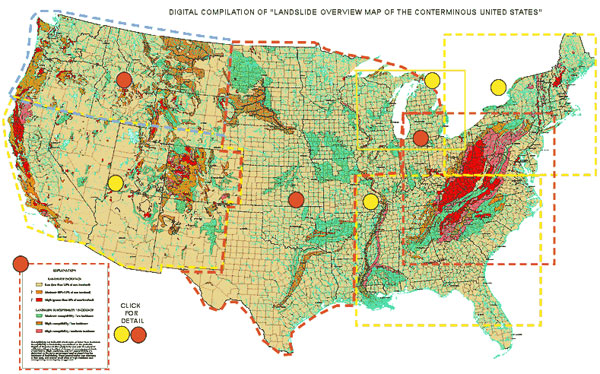
Landslide Overview Map United States Legend Landslide Incidence Low (less than 1.5% of area involved) Moderate (1.5%-15% of area involved) High (greater than 15% of area involved) Landslide Susceptibility/Incidence Moderate susceptibility/low incidence High susceptibility/low incidence High susceptibility/moderate incidence Susceptibility not indicated where same or lower than incidence. Susceptibility to…
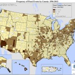
Live in a Flood Zone? FEMA Map of Flood Zones. Darker is higher frequency.
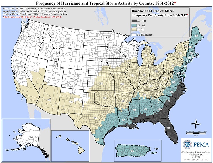
Live in a Hurricane or Tropical Storm region? FEMA Hurricane and Tropical Storm map. Darker is higher frequency.
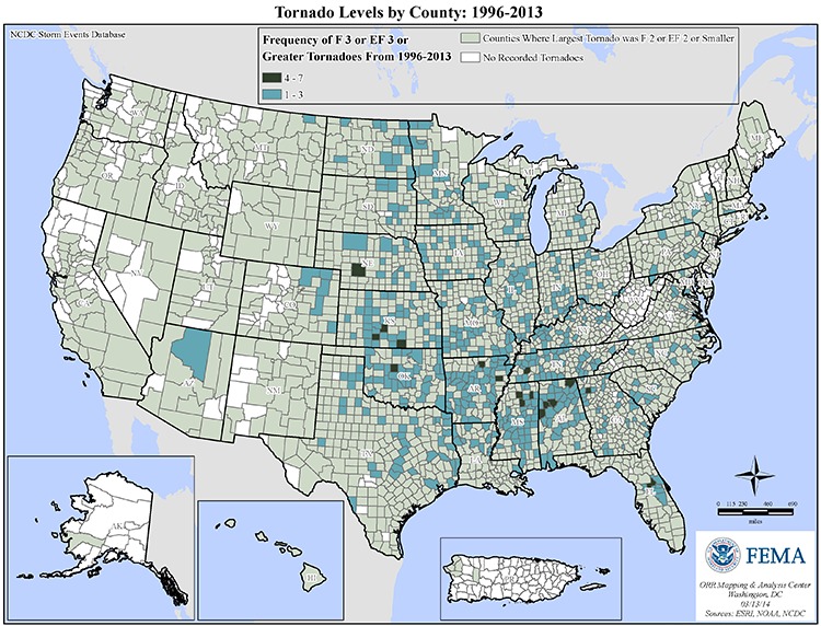
Live in a Tornado Zone? Darker is greater Tornado frequency. FEMA Map of Tornado activity.
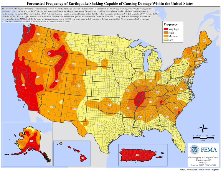
Do you live in an Earthquake Zone? Red is Very High Earthquake Frequency, Yellow is Low Frequency. See this FEMA map.

Do you live in an Extreme Cold Zone? If so, be prepared! See Fema Map. Darker is higher frequency for extreme cold temperatures. www.prepandbeready.com
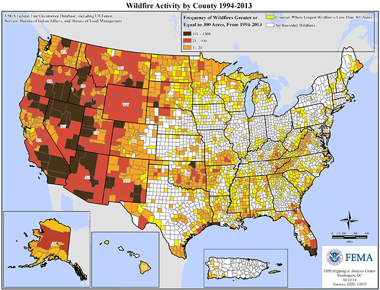
Live in a wildfire Region? FEMA Wildfire Map. Darker is higher frequency of wildfires. www.prepandbeready.com